For the last 7 years, I’ve jumped onto the the month-long (October) Inktober challenge, using prompts developed by the Zentangle community. This year I switched it up, deciding to follow the official daily word prompts, one word a day, creating images representing each word, solely in ink. The only rules I held myself to were: 1) only ink; no pencil sketching, and 2) create a drawing daily in 10 minutes or less. When I was all finished, it seemed some shading with Tombow brush pens was needed, and then Flambé wanted to play ….. but in color! Definitely a fun challenge! Here’s what I came up with.
Can you find all 31 of my ink drawings? What’s your favorite?
So what exactly is Inktober?
Inktober is an annual art challenge lasting for all 31 days of October. It was created by artist Jake Parker, with the purpose of improving art skills and developing daily drawing habits. Participants create an ink drawing daily, and Inktober.com posts an official list of word prompts to help guide you on this journey.
Even though there’s an official list of words to follow, “Inktober is just a framework to get yourself to draw better, flex a little, and/or have some fun with your art. Inktober is a challenge NOT a contest to see who the best artist is. It’s a challenge to see how much you can improve your art in a month, and to be inspired or to help inspire other artists to do the same.”
Here’s the official Inktober list for 2022
Anyone can participate, in any way imaginable. You can come up with your own list or search for the numerous lists created by many others, like the one of patterns posted annually by Zentangle. And you can use ink, pencil, paint or crayon. There’s really no rules, no wrong approach. Just make art every day in October!
Even though Inktober 2022 is officially over, you can still take on the challenge in the the following months, or anticipate and participate in the event in October 2023.
For more information, search the web for Inktober.com. I’d love to know if you go for it!
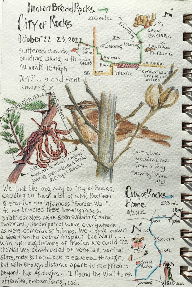
We usually know where we’re headed in the morning, but how we get there is another story. As we left Indian Bread Rocks we talked about optional routes to reach our destination …. City of Rocks State Park. There were several choices, and since we’re not interstate highway fans (unless absolutely necessary) we opted for the road less traveled; through New Mexico’s “Bootheel” in the extreme southwestern part of the state. Going this way we might just catch a glimpse of that infamous Border Wall too.
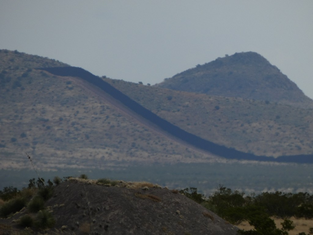
Although this route was the long way to City of Rocks (200 miles versus 110 miles), it was definitely eye-opening. As we traveled lonely roads, dodging no less than 3 huge rattlesnakes sunning themselves on the pavement, the only vehicles we saw were border patrol. It was windy and hot as we approached the Mexican border, and we strained our eyes to see something resembling a Wall off in the distance. Between Hachita and Columbus, NM, we could make out what looked to be a RR bed in the valley bottom. Binoculars weren’t much use, as this very straight line wasn’t resolving into a Wall, until ….. all at once we saw the RR track climb straight up a pretty substantial hill. That answered the question …. that faux track was indeed the Border Wall, and we had already seen miles and miles of it.
Border Wall
A short distance out of Columbus, driving very close to the border, we found a side road that appeared to lead down to the Wall, so we went to investigate. Coming within about a quarter mile of the Border Wall we saw how very tall it was, and how it was built with metal slats too close for a person to squeeze through, but spaced and angled just so to see Mexico beyond.
Border Wall
We’re both glad to have seen this Wall for ourselves. Rest assured I’ve no intention of turning my blog posts into political commentary, but I have to say this obscene border wall is absolutely embarrassing and offensive.
Border Wall
On to Columbus, North to Deming and to City of Rocks State Park.
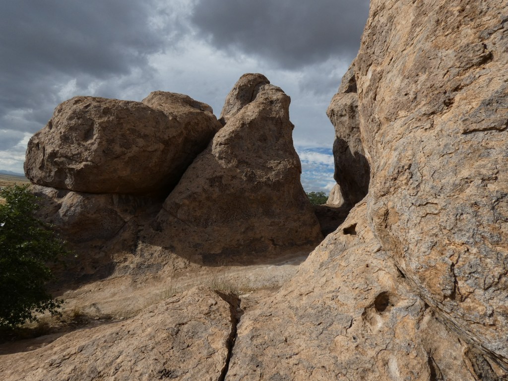
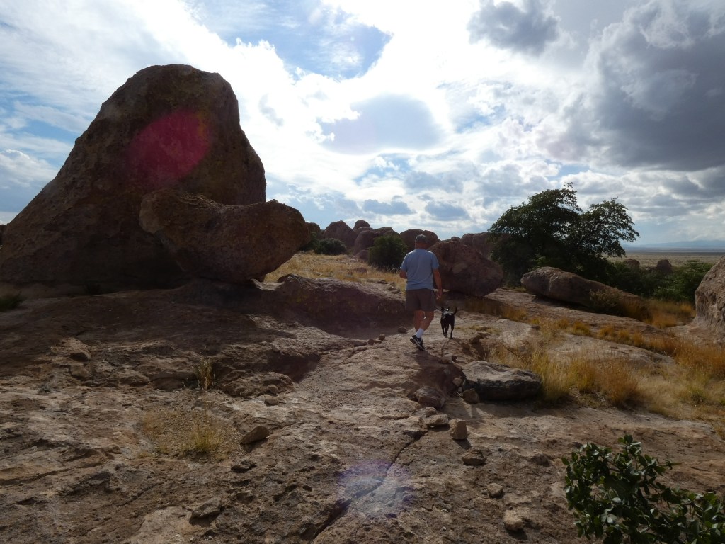
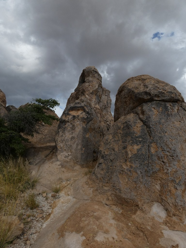
Our assigned campsite was a pull through and it was a snap to get The Felix all set up. Then it was off for a nice romp through the assortment of boulders that were created from volcanic tuff and eroded over years to form what appears like, from a distance, a city of high rises. There’s a marked trail through the rock formations that lead you to some of the best rocks and views. But it’s more than okay to wander wherever your legs take you … and sometimes it’s like a maze with many dead ends. The Park also has a nice botanical garden, many “outside the city” trails, and a super visitor center with helpful volunteer staff offering info like lists of plants, birds, insects, reptiles and mammals you might encounter in the park.
Discovering City of RocksRoy and Luna rock hopping
Before a big cold front blew in bringing rain and winds, I was able to do some sketching, we spotted lots of new-to-us plants (still in bloom) and a gorgeous rainbow grasshopper. Several birds (cactus wren, curve-billed thrasher and canyon towhee) paid us a call at The Felix. About to go searching for the covey of scaled quail making quite a racket somewhere in the rocks, we changed that plan ….. a good decision as we would’ve gotten drenched with rain!
Rainbow grasshopper calling City of Rocks homeThe approaching storm made for nice photosCat-claw Mimosa
This was our third trip to City of Rocks, and not likely to be our last. It’s a fun place to visit for a short time or an extended stay.
Before the storm
We were going to enjoy one more day in SW NM east of Las Cruces before returning home, but the weather forecast for the next many days called for high winds, rain and snow ….. so, not at all disappointed in all the ground we covered we came home a day early, driving all 283 miles in good time thanks to a tail-wind assist.
(Turns out the next day, had we stayed one day longer, would’ve greeted us with rain, freezing rain and snow by the time we got home. I could feel it in my bones!)
All in all it was a great Escapito #6, all 4 stops and the 922 miles in between, and a fun way to close out the 2022 camping season (or is it?!). Stay tuned!
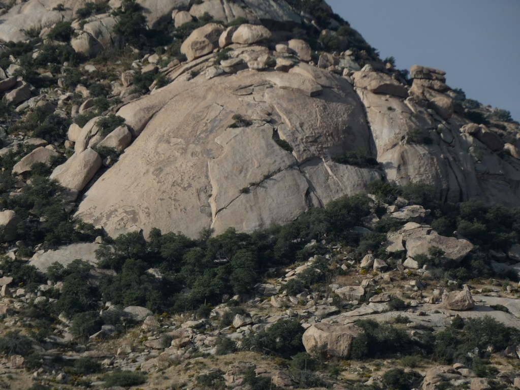
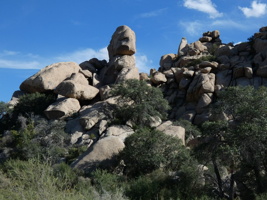
Another short (96 miles) drive took us from Clifton, through Safford (to find ice cream ….. it’s getting warm!), and then south of the nearly deserted town of Bowie to visit a sprawling garden of giant granite boulders called Indian Bread Rocks. We seem to find the most amazing collections of boulders and rocks around, and this area didn’t disappoint. Unable to find out the origin of the name “Indian Bread Rocks,” this new-to-us recreation area sits in the foothills on the northeast fringes of Dos Cabezas Mountains Wilderness Area …. both areas managed by Bureau of Land Management (BLM). Public lands “Rock!”
Scene just before entering Indian Bread Rocks Recreation Area …. Previews! Dos Cabezas Mountains in the background
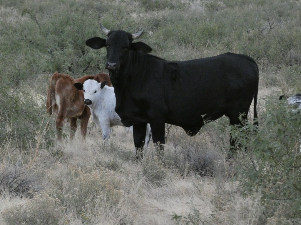
To access Indian Bread Rocks (maybe the name came from the big loaf-shaped boulders?), you must first pass by a few miles of pistachio orchards looking ready to harvest. Wonder where the irrigation water for these big trees comes from way out in this desert? We then made a southwest turn onto a gravel road (Happy Camp Canyon Road) and in 3 miles we arrived at the designated Indian Bread Rocks picnic area, “sandwiched” between extremely large boulders. No camping here tho … so we continued on up the deteriorating two track road, pushing bawling cows out of our way. These free-range Brahman bulls, cows and calves turned into camp visitors after we set up about 3/4 mile beyond the picnic area.
Entering Indian Bread Rocks Recreation Area ….. a loaf with a face?
With the rocks calling louder than the bellowing livestock, we brought The Felix to rest and took off on foot, walking further up the dusty road to scope out the area for a longer hike after temps cooled down a bit (85 sunny degrees and loving it!).
Free range Brahaman cattle
The surrounding granite boulders really were very excellent, and seemed to be animated as well. Many looked like bakery goods; loaves of bread, pancakes, popovers and muffins. Some reminded me of dinosaurs like T-Rex and triceratops. There were precariously balanced hoodoo-like boulders, and many with dark hiding places that make perfect roosting places for bats (which we enjoyed at sunset).
Discovering Indian Bread Rocks
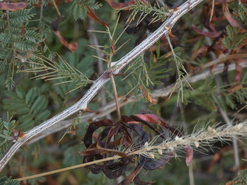
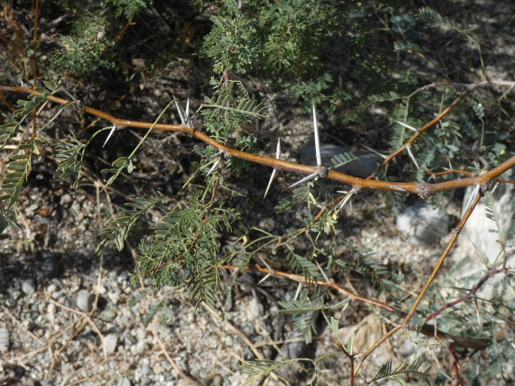
Indian Bread Rocks plants consist of Chihuahuan desert species with impossible-to-navigate and tire penetrating thorned mesquite, and 6 foot tall spiny prickly pear choking the valley floors. But up small riparian areas (mostly dry washes where water may flow during the monsoon season) we found large oak trees, ocotillo, intermittent water dependent mesquite and cat claw mimosa, sotol and many other shrubs, wildflowers, ferns and grasses. We didn’t hear many birds, but they were around, and we found an assortment of insects (grasshoppers, true bugs, beetles and wasps) flying, hopping and snacking on desert plants.
A mesquite branch sporting those tire penetrating thorns!
One of the most common insect was the Comanche paper wasp; seen flying everywhere, with exaggeratedly long yellow hind legs hanging down as they flew. I learned this species of wasp is common here, and colonies of 25-30 build paper nests between the rocks and in the dense vegetation. They didn’t seem aggressive but we were careful to keep The Felix well buttoned up while we explored, as we camped in a small opening surrounded by large velvet mesquite.
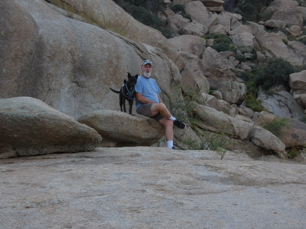
Comanche paper wasp warming up in the morning sunIndian Bread Rocks sceneryRoy and Luna … a bit of a rest from hikingIndian Bread Rocks scenery
I dare say Indian Bread Rocks was the highlight of our Escapito. It’s always fun to explore new areas. But revisiting familiar areas is also lots of fun. Our next stop, City of Rocks State Park, north of Deming, NM is one of our favorite places ……. for rocks! Can’t get enough.
Stay tuned for Part 4 of this Summer Sequel: Indian Bread Rocks, AZ to City of Rocks, NM
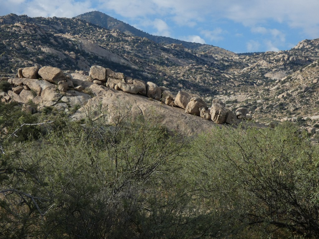
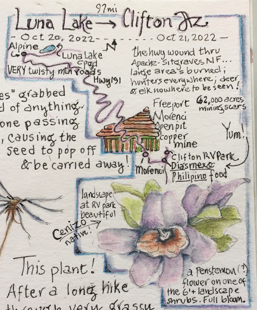
Even though we had a mere 97 miles to travel today, we knew the road would be long and winding, up and down, as we dropped over the Mogollon Rim at 8000 feet to the Northern Chihuahua desert at 4000 feet. And yes indeed, it was a slow go, but worth the drive as we passed through the Apache-Sitgraves National Forest. This dry forest, dominated by old growth ponderosa pine, had recently burned in many places turning visually impenetrable mountains into scenic, long distance views. As we neared the town of Morenci towards the end of our day, the country literally fell apart due to a gigantic open pit copper mine. We passed by the remains of leveled mountains reconstructed with overburden, impossibly deep terraced pits, and parades of the largest dump trucks ever, carrying freshly blasted raw materials to be processed into copper plates. Morenci is Freeport’s flagship copper mine (Freeport is part of a gigantic international mining conglomerate) and at 62,000 acres in size, there’s every indication of continued expansion. Wow.
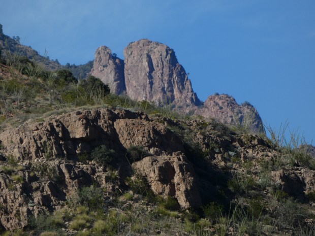
Rugged country north of Clifton
It took about 45 minutes to wind through the countless open pits before we actually reached the town Morenci with Clifton just 10 minutes beyond. We had arrived; surrounded by desert, with the forest of trees behind us just a memory.
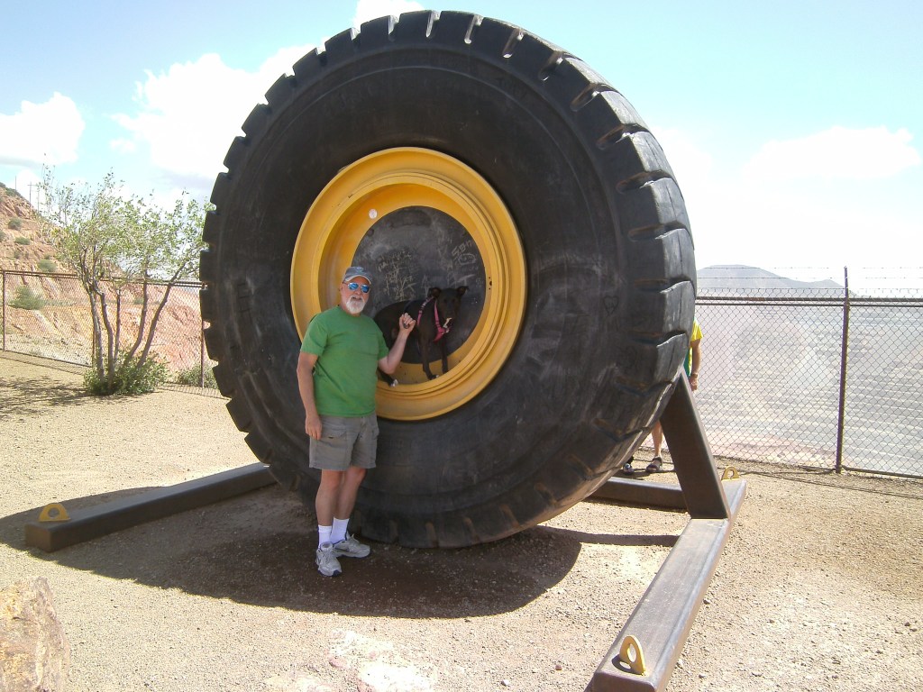
Roy and Luna showing the tire size from one of the dump trucks used at the mine
We stayed at a very nice RV park in North Clifton, being lucky to snare the last available site (all other sites were occupied by miners and their families). The park is advertised as being along the beautiful San Francisco River, which looked like rapidly flowing chocolate milk, but the canyon provided plenty of hiking opportunities …. and we spent the afternoon and following morning exploring, before journeying deeper into the desert.
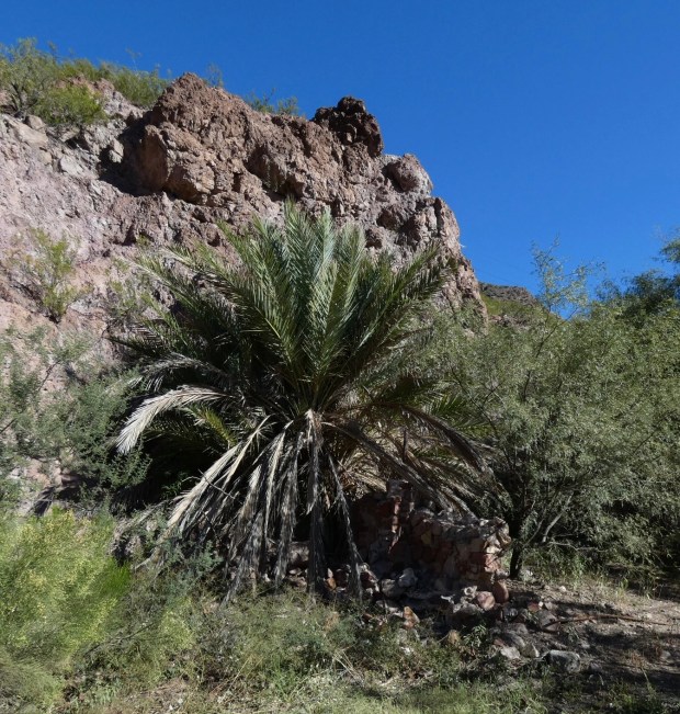
San Francisco RiverDate palm growing beside the San Francisco RiverVelvet mesquite growing alongside the San Francisco River
Stay tuned for Part 3: Clifton, AZ to Indian Bread Rocks, Bowie, AZ
A long first day drive (250 miles) towing The Felix, fully laden, on slow and windy roads. West then south through scenic el Malpais, Quemado (a Catron County stronghold), and into Arizona, all while enjoying beautiful high desert scenery, mountain islands like the Sawtooths (Escapito #3), and open grasslands dotted with pronghorn. First stop, Springerville for fuel and sticker shock! With only 2 places to buy gas, the Circle K coming into town and the Circle K leaving town, we settled on Circle K. Hahaha! Fueled up we were back on the road heading south to the pretty little village of Alpine, AZ 8,000 feet high in the Apache-Sitgraves NF. From there it was a short 5 mile hop back east where we found Luna Lake and our forest campground for the night. The Forest Service closed all but one loop, shut off the water for the season, and didn’t charge for camping! Other than 2 other trailers, we pretty much had the place to ourselves and picked a site with a view of the lake.
Beware the Wicked Seed
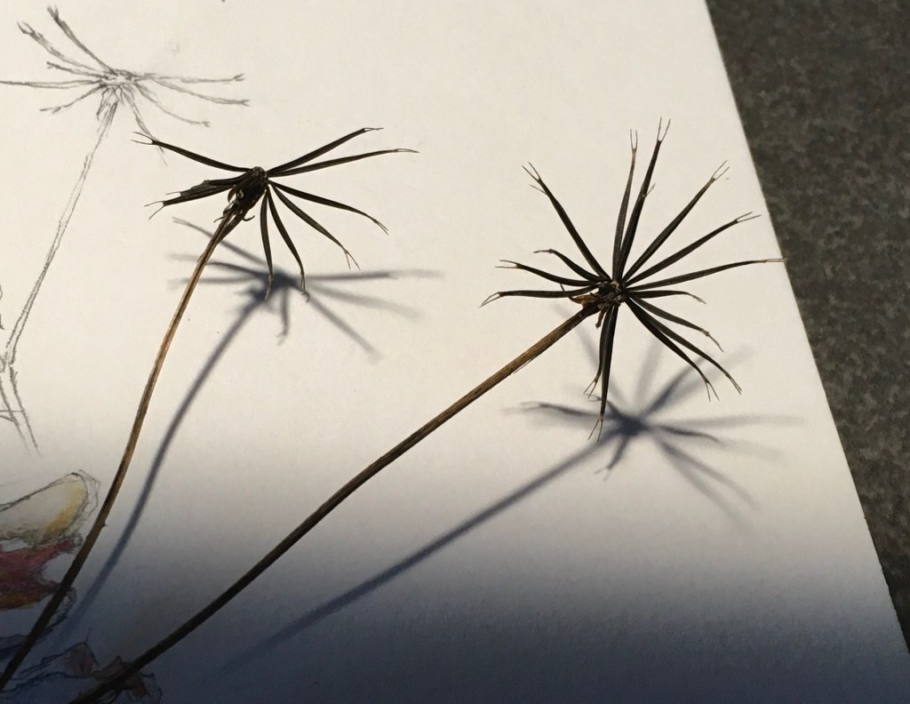
Anecdote ……Pins and Needles or The Case of the Wicked Seed: after a long drive we were ready for a hike. But choosing a cross-country trek through tall vegetation was a mistake. Nearly all the wildflowers and grasses had dried and gone to seed, and being fully loaded with ripe seeds, our pant legs, socks and shoestrings provided them an ideal way to disperse. One seed in particular was especially wicked! About 1.5” long and skinny, this hard bugger was tipped with 2 hooks on fork-like tines. Any whisper of contact with these seeds resulted in them leaping out from the seed head and hooking on for a ride. I’m not sure how their grabbers release their grip and drop to the ground, because when we returned to The Felix, we must’ve been carrying 100s of them embedded in our pants with the bottom ends of the hard sharp-pointy seeds lined up like soldiers ready to attack at the slightest threat of extraction. Ouch! After a consult with iNaturalist, submitting only seed photo, the database turned up one possibility ….. Spanish Needles! A brilliantly named member of the sunflower family. I’ll take dandelion fluff any day!
WIP
We enjoyed our stay at Luna Lake …… in the morning we woke to the sound of elk bugling in the distance, owls hooting overhead, and a respectable coating of frost in everything. A brisk 1 mile hike on Forest Service roads covering all the campground loops (we weren’t about to venture into the grass ….. oh no way!) warmed us enough to pack up camp and head south in search of summer!
Stay tuned for Part 2: Luna Lake to Clifton, AZ
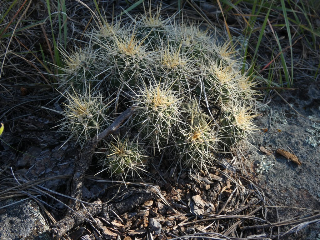
An excellent cluster of Santa Rita Hedgehog cactus (no matter where you are in the desert SW, watch your step!)
So much rain! Not complaining ….. we need the moisture. But with days of drenching rain falling in the East Mountains and the Sandias this entire week, summer seemed to flip into Autumn in a matter of days.
Trying to capture the last remnants of fading flowers, I was inspired by a remarkable naturalist and artist, Jean Mackay, to get out there and rescue blooming bits before everything turned brown and crunchy.
Thanks Jean, for the encouragement, and always helpful tips and techniques in creating interesting journal pages. My hike this morning revealed some surprise bloomers that I wanted to remember in my nature journal.
And thanks to my many followers for your continued interest in my discoveries!
“The Felix” was loaded and ready for a fun boondocking adventure through forest and desert, ghost towns and lava flows, rainbow colored ridges and badlands. Central New Mexico is a splendid place to explore and discover wildlife, geology and spectacular scenery.
Come on along with us for 4 days of camping fun in the Land of Enchantment.