Part 1 – Diatomaceous Earth
August 31, 2025
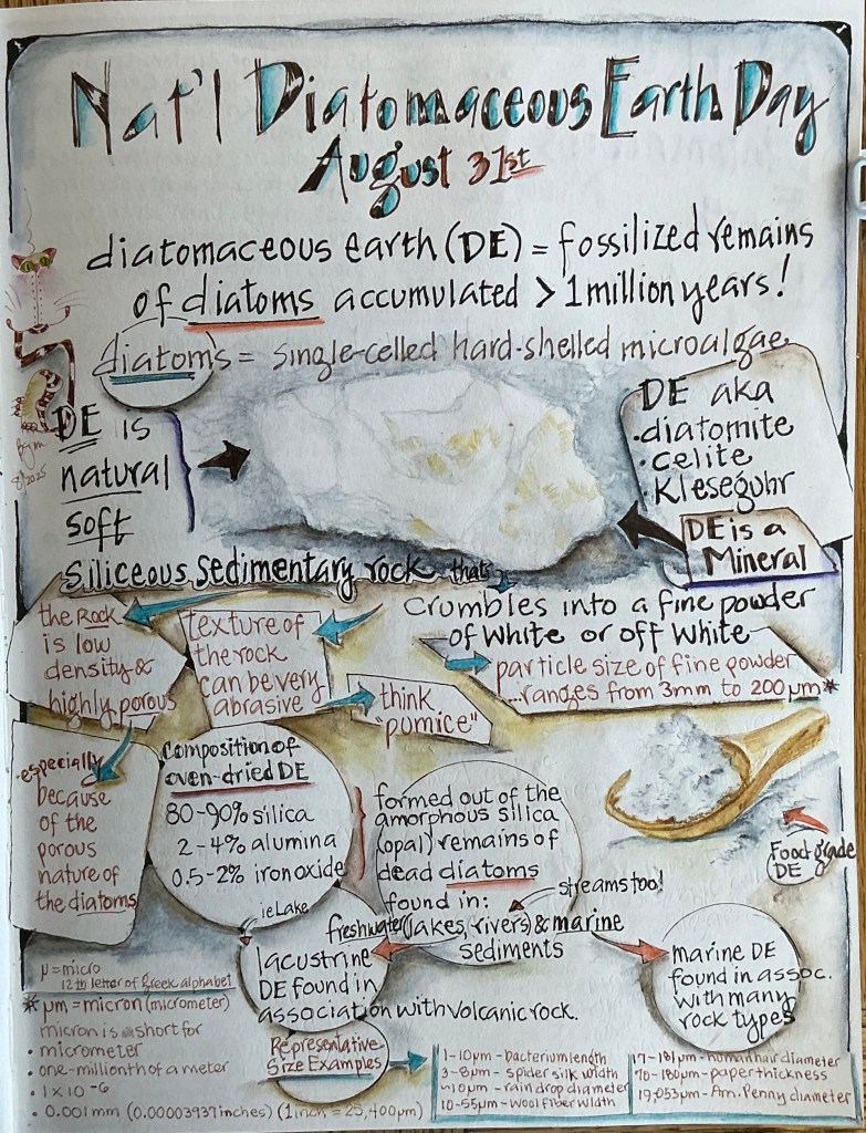
On August 31, National Diatomaceous Earth Day recognizes the diatom and the remarkable mineral it creates!
Have you ever heard of Diatomaceous Earth (DE)? If you answer “yes” then perhaps you brew your own beer, have a swimming pool in need of water filtration, or a vegetable garden that’s been invaded by a herd of hungry slugs. But did you know DE is a mineral1 composed of the fossilized remains of single-celled, microscopic algae called Diatoms? (More about diatoms in an upcoming post.) DE is truly a remarkable mineral, found around the world in ancient marine and lacustrine (freshwater lakes, streams, and rivers) sedimentary deposits.
Early Discoveries and Uses of DE
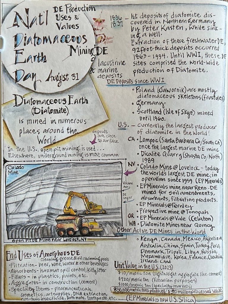
The year was 1836; the place, Northern Germany …… One day, a peasant named Peter Kasten was sinking a well when he encountered a mysterious-to-him layer of rock. Curious what this soft powdery rock might be, Pete took a sample to a friend who was a friend of a friend learned in the science of geology. This geologist carefully examined the rock then exclaimed (in German, of course), “Why this is the much prized and never-before-seen-in-Northern-Germany mineral known as Diatomaceous Earth! It has remarkably unique abilities to absorb, filtrate, polish, and stabilize! These qualities make Diatomaceous Earth (aka Diatomite) valuable and much sought after by numerous industries!”
Well, word spread and immediate exploration of the area commenced. It wasn’t long before numerous substantial deposits of lacustrine DE were discovered; some up to 92 feet thick! Extraction began in 1863. Until WWI, these sites comprised the world-wide production of Diatomite. Mining these deposits ended in 1994, when all of the DE deposits had been extracted.
But long before Pete’s discovery, Ancient Greeks used DE as an abrasive as well as a building material in lightweight bricks. Even in pre-historic times, DE was used in the ice-age cave paintings in France.
DE Deposits and Extraction – Worldwide
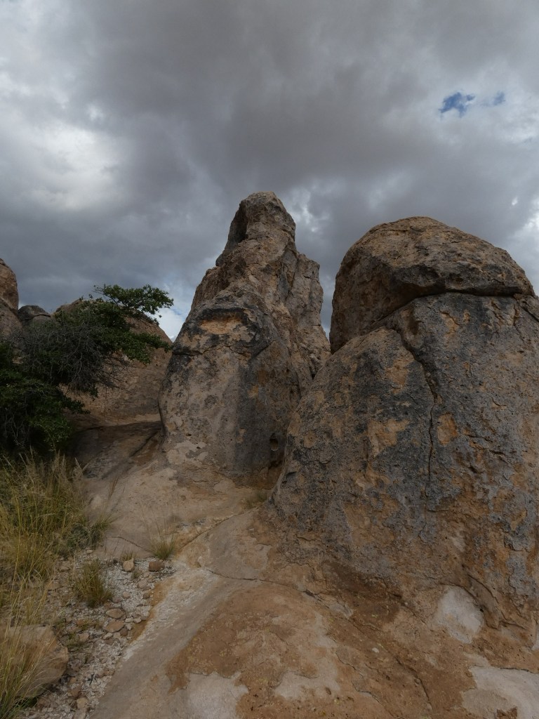
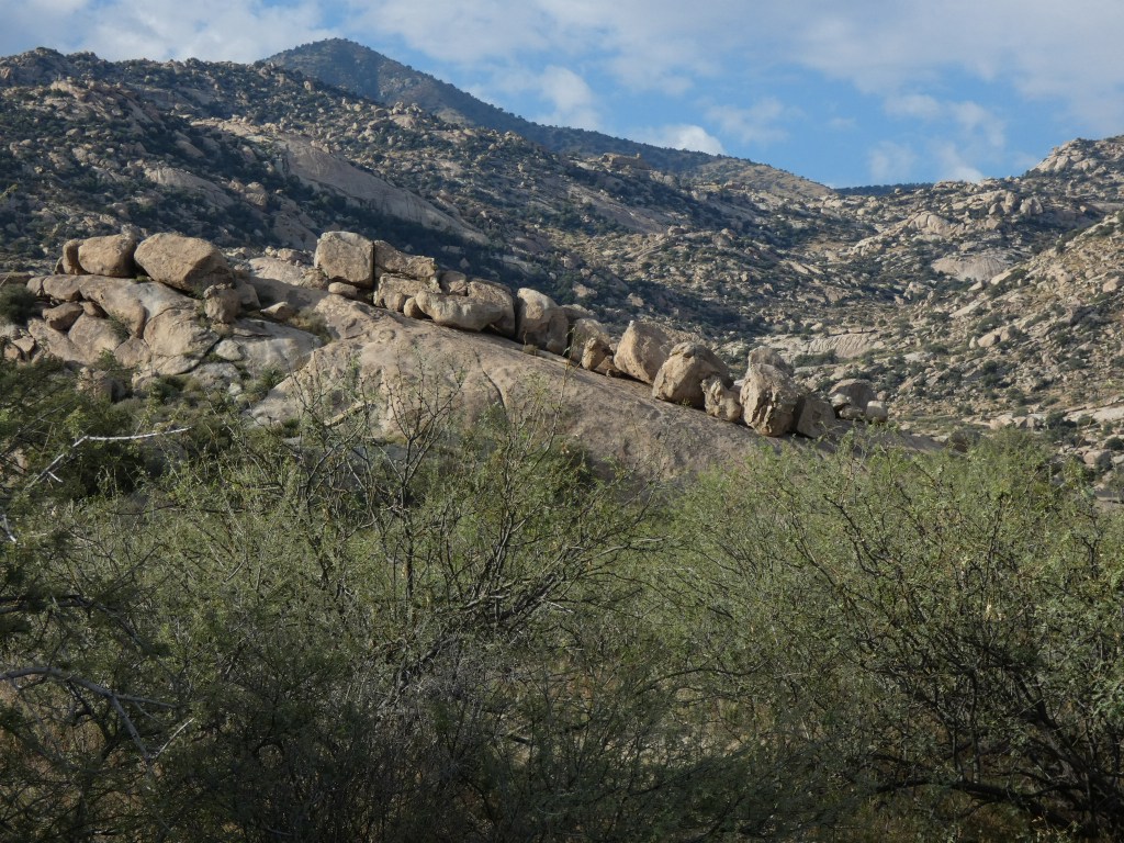
When diatoms die and fall to the bottom of marine and lacustrine waterbodies, they form large deposits. Over time, the organic portions of the diatoms weather away, leaving behind their hard silica shells. These remaining shells, called Frustules, with their opaline-like quality are what forms DE. Some of the largest deposits in the U.S. formed in ancient lakes that existed in California, Nevada, Oregon, and Washington. They also formed in oceans and occur along the coasts of North and South America.
Since WWI, exploration for and discovery of numerous DE deposits have occurred worldwide-wide, and are still on-going. Large mining companies have unearthed and continue to extract this mineral in substantial quantities, which is processed for use by industries that manufacture products for home and business (more on that below). DE deposits are (or have been) mined in many countries around the world, including the U.S., Mexico, Chile, Peru, France, Spain, Denmark, China, Canada, Argentina, Australia, Spain, Turkey, Libya, Russia, Mozambique, Ireland, and France. Today, the world’s largest DE mine, Colado Mine, is located just outside of Lovelock, NV, and has been in operation since 1959.
DE’s Modern Uses and Values
Today, DE is one of the most useful and durable substances known. The white to off-white powdery rock that makes up the more than 1 million year old DE deposits, is used in many common products likely encountered every day. One nearly universal use is in the filtration of liquids like the beer, wine and water. DE is also used to filter water in swimming pools, and to clean grease and oil. DE is used as an absorbent for hazmat spill control and in some kitty litters. As a filler in paint, it removes the sheen making flat paint flat; in plastics, it prevents blocking in plastic film. DE is used as an aggregate in construction, particularly in Portland Cement. And the list of specialty items that use DE for a variety of purposes is very long ….. including pharmaceuticals, cosmetics, art supplies, in the medical industry for DNA extraction, as a non-toxic insecticide, soil amendments, in bath mats for quick drying, in toothpaste as an abrasive, and as food additives to control moisture and extend shelf life. There are hundreds of other applications for DE with many more yet to be discovered!
But the biggest use of DE is in filtration. In 2023, the beverage industry paid $720/metric ton for processed food-grade DE (amount used to filter a keg of beer??). Compare that cost to $10/metric ton charged in 2023 for lightweight aggregates used in construction (wonder if or how tariffs impacted the 2025 cost?), or the $1000/metric ton charged for some specialty items.
Ideas on How to Observe Diatomaceous Earth Day
Discover more about DE, and learn about its common uses around your home or work.
Read product labels to learn what you use on a daily basis that contains DE.
Consult the fda.gov website to learn more about labeling.
Visit a Diatomite mining operation.
Learn about unmined deposits near where you live.
Use a magnifying glass or microscope to inspect the contents of bag of insecticidal DE.
Stay tuned for NATIONAL DIATOMACEOUS EARTH DAY – Part 2 – Diatoms! They are ultra-fascinating!
As always, thanks for stopping by!
1 Minerals are naturally occurring, inorganic solids with a definite chemical composition and internal structure, and are the main components of rocks. DE (Diatomite) is a naturally occurring inorganic mineral that forms from the fossilized siliceous (silica-based) skeletons of diatoms, which are single-celled aquatic organisms. While the organisms themselves are organic, the hard, porous mineralized skeletons they produce are considered inorganic.
Being an inorganic mineral, DE falls into the same category as minerals we’re all familiar with, such as Quartz, Feldspar, Mica, Pyrite, Hematite, Galena, Sulfur, Gold, and Copper. The chemical formula of DE is primarily SiO2 (silicon dioxide), with traces of other minerals.